Last week, we published a blog post with a call for volunteers from the tech community to help the University of Pretoria’s Sustainable Development Goals Hub build a beta map to track the impact that COVID-19 could have on South Africa’s most vulnerable communities. The goal was to help support the government in their fight to keep the people of South Africa safe during this pandemic through the use of this mapping tool.
We had a really encouraging number of responses from the tech community with both individuals and companies generously volunteering their services. Individuals and teams from a host of companies – including ESRI, Here Technologies, Qode Health, Quantium, Riskscape, CSIR, Mashlab Digital, Aerobotics and WhereIsMyTransport, to name a few – volunteered to assist with everything, from GIS mapping to data preparation and visualisation, and even building the entire interface.
Due to the urgency of this project, we needed to maintain good traction so we started hosting video calls for planning and set up a WhatsApp group for regular check-ins. These touchpoints were really helpful in getting the tool built really fast.
The tool maps out how vulnerable communities could be affected by the virus by identifying 15 different aspects of the population over two layers – namely disease spread and disease severity. The aspects that are examined include population density, the ability of individuals to self-isolate, access to health care and health vulnerability, amongst other things, and were weighted and validated with input from a lot of different people, including various public health specialists and the National Department of Health’s (NDoH) COVID-19 team.
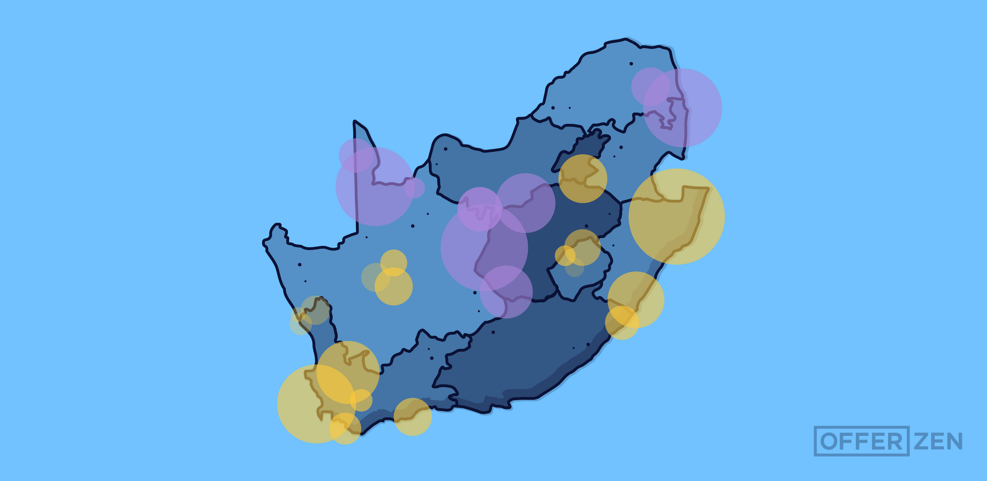
Here's an idea of some of the interesting maps that we looked at during the collab:
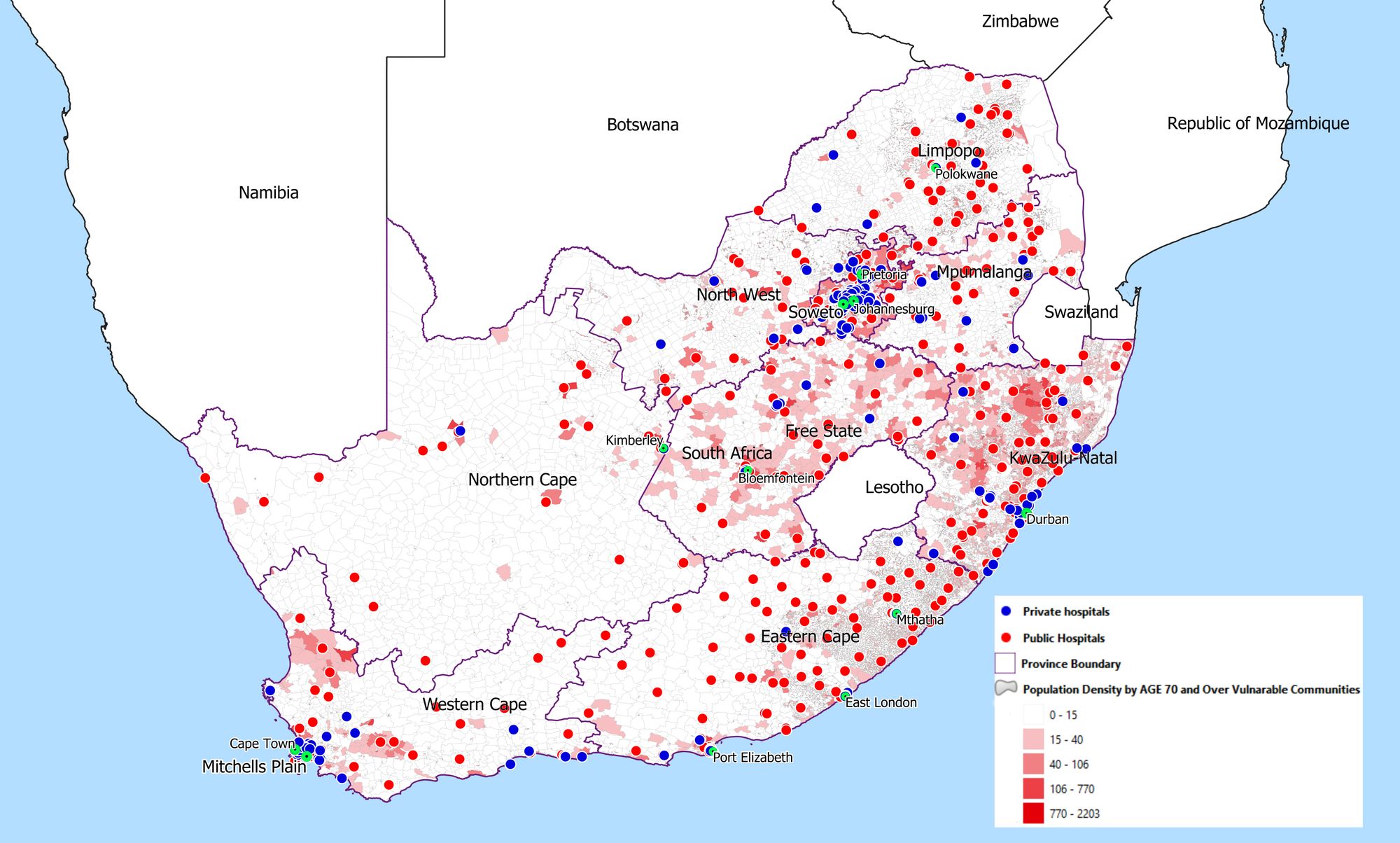
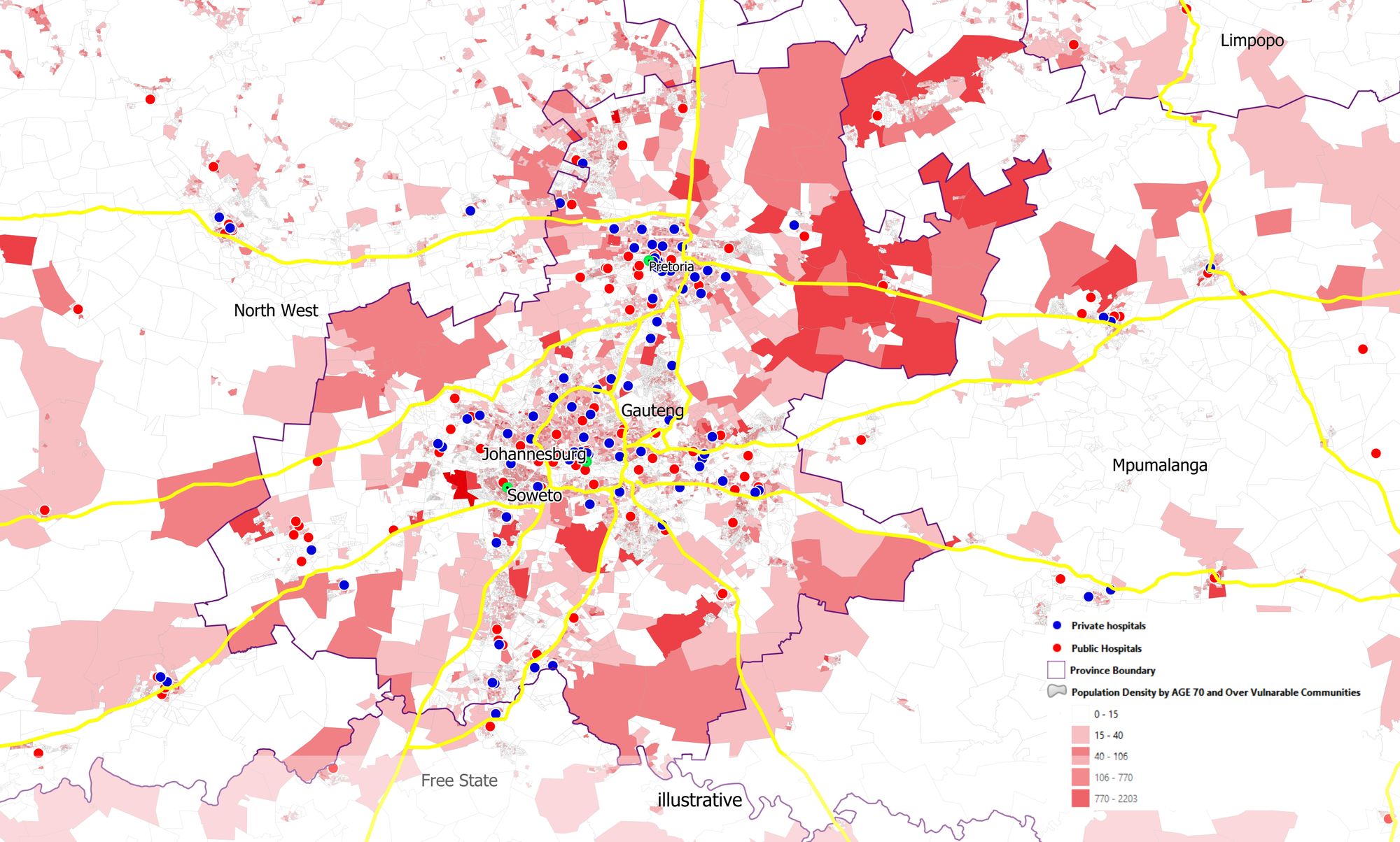
Excitingly, the mapping tool is now being incorporated into the NDoH’s national platform, meaning it will play a role in assisting government planning on how to most effectively respond to COVID-19 in vulnerable communities. There is even talk of the map being shared with neighbouring countries to help them #flattenthecurve.
This was a really great collaborative effort and it was overwhelming to see the tech community's response in such a short space of time, so thank you to everyone who volunteered to help!
Our plan is to keep working with the government to identify other critical projects where the tech community can help in this time of need. Subscribe to our blog for updates on how you can get involved!